
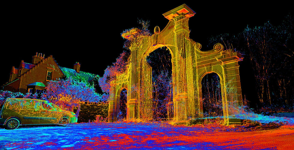


Founded in 2018 and based in Edinburgh, AOP Surveys provides comprehensive surveying and inspection services. We utilize cutting-edge technology, including 3D laser scanning and UAV platforms, to deliver accurate and efficient results. Our services include topographical and MBS surveys, facade surveys, and detailed 3D modeling, including CAD and BIM. We also offer professional photography services, including virtual tours. Whether you require a detailed survey of a complex structure or an inspection of a hard-to-reach area, AOP Associates has the expertise and technology to meet your needs.
At AOP Surveys, we believe that quality is a key so that everything we create is produced with high accuracy and precision.
Working Together
Across numerous industries, we help clients overcome project challenges. Whether you're exploring a new site, managing an ongoing project, or dealing with an existing building, our services ensure your project's progress.
18+
Years of experience
Engineers
We provide precise topographic and utility data, enabling engineers to design accurate and efficient infrastructure and construction plans.
Project Management
We supply critical survey data for project planning and execution, helping project managers maintain schedules and budgets.
100+
clients
Architects
Our detailed land surveys and laser scans deliver accurate site information, facilitating precise architectural design and renovation projects.
Construction
We offer construction layout and as-built surveys, ensuring projects are built according to design specifications and with accurate measurements.
Facility Management
We deliver as built surveys and 3d scans, to enable accurate facility planning, and maintenance.
Insurance Companies
We supply accurate land and structural data, to aid in risk assessments, and to help in property valuation.
700+
projects complete
Real Estate
We provide topographical and boundary surveys, giving real estate professionals and their clients accurate property information for transactions.
Local Councils
We deliver accurate data for planning, infrastructure development, and land management, supporting local council projects and initiatives.

We've been there with our surveying tools, meticulously mapping everything from bustling cityscapes to remote mountain ranges. Explore our interactive map and virtually traverse our vast surveyed territory – no hiking boots required!